|
16 JANUARY 1983

 |
 |
|
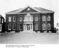
The Administrative Centre of Lisburn Borough
Council, Borough Offices, The Square, Hillsborough. |
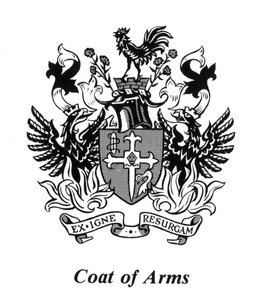
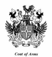
Coat of Arms |
The fleur de lys on the extremities of the cross
refer to the town's historic connection with the Huguenots.
The bishop's mitre is reference to the fact that for
three centuries there has been a cathedral in Lisburn.
The weaver's shuttle and the sprigs of flax are
symbolic of the linen industry. The ostrich head with the horseshoe
on its beak are from the arms of Sir Richard Wallace and refer to
his fame as a collector.
The mural crown, that is the crown in the form of a
wall with battlements, is the badge of a municipality.
The gamecock is a punning reference to the old name
of the town - Lisnagarvey, the fort of the gamesters.
The two phoenix rising from the flames and the motto
"I will arise out of the fire" refer to the fact that the town was
twice burnt down and rebuilt in its early days.
With a population of around 84,000 the Borough of
Lisburn is one of the fastest growing areas in Northern Ireland. In
its present form the Borough dates from the local government
reorganisation that took place in 1973. In that year the former
Lisburn Borough (which had been an Urban District from 1899 to 1964
and a Borough from then on) was abolished and replaced by the new
and larger authority which extends beyond Lisburn itself to include
numerous other towns and villages -including Moira, Dromara,
Glenavy, Dunmurry and Hillsborough.
This large Borough is an area of contrasts. On the
one hand are the hills around Dromara and the undulating drumlin
country of Down; on the other are the busy built-up areas of the
Lagan Valley and, again in direct contrast, the quiet shores of
Lough Neagh which, at beautiful Sandy Bay, offer fishing, boating
and bathing.
The views across Lough Neagh to the distant Sperrin
Mountains are very lovely and can best be enjoyed from the heights
at Bohill above Dundrod or from Glenavy's Crew Hill, a place where,
in ancient times, the Kings of Eastern Ulster were crowned.
As a place of residence, Lisburn is ideally sited.
It is almost on the outskirts of Belfast yet is in the heart of the
Lagan Valley. It is astride the main north-south routes and from it
others lead to the centre of the Province. Good rail and road links
are provided to Belfast and major provincial towns and Lisburn is
also close to Aldergrove Airport, the main air terminal in Northern
Ireland.
Lisburn, whose history has been long and varied, is
now a thoroughly modern Borough, easily accessible and growing in
stature as a residential area.
Northern Ireland's story goes back many thousands of
years and the landscape of Ulster today has been moulded through
that time, the thickly forested and lake strewn country of earliest
times having given way to well farmed land and smooth hills of
today. Ever since the time, over four thousand years ago, that Irish
men began to till the land, changes have been a continuous process
although, it has to be admitted, not all have proved to be for the
better.
During the last millennium B.C. successive invasions
brought a Celtic culture and language to the shores of Ireland and,
although not completed until the early years of Christianity, this
process eventually saw a Celtic hierarchy established throughout the
country. From about 300 B.C. onwards man began to adopt iron cutting
tools and these allowed him to adjust to his environment. Cattle
rearing became a major occupation and the need to protect himself
against raiders also became an important factor in everyday life.
Indeed protection was needed not only against raiders but against
packs of wolves which roamed the countryside. This helps to explain
the many earth or stone-ringed farmsteads (raths and cashels)
which are still found in the fields. These constructions belonged to
the more important farmers who were, in all probability, descended
from the Celts.
The ancient culture of the Gael, in which the clan
provided the social base and farming was the economic base, finally
broke before superior forces and widespread devastation resulted.
The forests were destroyed and roads and fortresses were built thus
dividing and isolating the various districts of Ulster. Indeed the
struggle between Ulster and Elizabethan England, which ended in 1607
with the Flight of the Earls, was a battle between two
civilisations. The Gaelic way of life, however, was far from being
the barbaric nomadism that contemporary English writers and later
historians portrayed it; it was, with its aristocratic traditions,
ancient laws and spoken literature, on a very much higher plane than
generally supposed.
The Gaelic way of life was a pastoral one and had no
need of urban centres. Even by 1600 the only places with urban
pretensions were such small post towns as Ardglass and
Carrickfergus, places founded by the Normans. The 17th century,
however, brought the plantations which were concerned with the
setting up of market towns. These, although small, became centres of
administration and influence and their markets and fairs became
regular features of local life. These new towns helped the Ulster
plantation to success and they became the main instruments through
which was built up a n awareness of the Protestant tradition of the
English and Scots.
The period of Irish legislative independence, from
1782 to 1800, was a period of prosperity for both landlords and the
people of the towns. Much money was spent on roads and new 'public
works'; the market towns grew and, in many cases, were replanned.
Some wholly new towns, with their wide main streets, were built. In
most Ulster towns the oldest houses and inns date from these years
at the end of the 18th century. Many farmhouses and country mansions
were built or reconstructed at or just after this period.
It is against this background that the towns and
villages of Lisburn Borough should be seen.
 |
 |
|
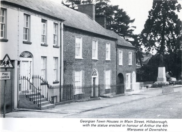
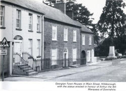
Georgian Town Houses in Main
Street, Hillsborough, with the statue erected in
honour of Arthur the 4th Marquess of Downshire. |
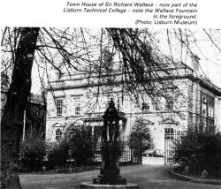
Town
House of Sir Richard Wallace - now part of the
Lisburn Technical College - note the Wallace
Fountain in the foreground. (Photo: Lisburn
Museum) |
In 1609 the territory of Killultagh, which 'fans
out' from Lisburn to Lough Neagh, passed to Sir Fulke Conway who
brought the first settlers to build the town which was then known as
Lisnagarvey. The town's growth was interrupted by the Irish
Rebellion of 1641, when it was first burnt, but it was the
accidentally started 'Great Fire' of 1707 which destroyed
seventeenth century Lisburn. Only fragments survived this
conflagration, but the 1677 gateway in Castle Gardens, which remains
from the Conway Manor House, and the arches of the Market House in
the interior of the Assembly Rooms, are architecturally important,
as few pre-Georgian secular buildings in Ulster still exist.
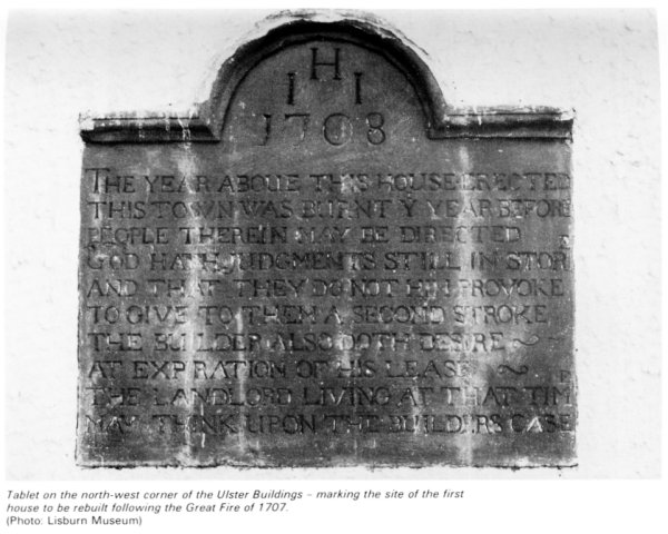
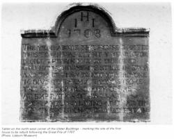 |
Tablet on the north-west corner of the Ulster
Buildings - marking the site of the first house to be rebuilt
following the Great Fire of 1707.
(Photo: Lisburn Museum) |
After the fire a new town which kept the seventeenth
century street plan grew with the prosperity of the linen industry
and is often described at the end of the eighteenth century as 'the
handsomest inland town in Ireland'. In 1698 William the Third had
appointed Louis Crommelin, a French Huguenot refugee, to promote the
linen industry. Crommelin chose Lisburn as his headquarters and
encouraged many Huguenot families to settle in the town, giving
Lisburn the right to regard itself as the capital of the Irish linen
industry. The importance of the linen industry to Lisburn continued
to modern times with such world famous firms as Coulsons, Barbours
and The Island Spinning Mill producing fine damask or linen thread.
In the 1798 Rebellion it was a Protestant linen
merchant, Henry Munro, who led the United Irish insurgents in County
Down. Munro was hanged in Market Square opposite his house. In the
nineteenth century the most famous people connected to Lisburn were
Sir Richard Wallace, M.P., who inherited the Seymour-Conway estates
in 1870 and General John Nicholson who grew up in Lisburn and became
the hero of the siege of Delhi in the Indian Mutiny. Both are
commemorated by fine monuments, that of Nicholson by a bronze statue
by F.W. Pomeroy, R.A., in the Market Square and Wallace by a
Ruskinian gothic memorial in Castle Gardens.
One of the most interesting buildings in Lisburn
today is Christ Church Cathedral (Church of Ireland) which is tucked
away behind the houses at the east end of Market Square. Originally
built in 1 623 as a chapel for the Conways it was granted Cathedral
status in 1662 when Charles the Second also made Lisburn a
Parliamentary Borough sending two Members to the Irish Parliament in
Dublin. The Bishop appointed at the Restoration in 1660 was the
famous Royalist divine Jeremy Taylor. Bishop Taylor died in Lisburn
in 1667 and is buried in Dromore Cathedral. The present Cathedral
was built after the fire in 1708 with the octagonal spire added in
1804.
At much the same time the very elegant cupola was
erected on top of the Assembly Rooms in the centre of Market Square.
Recently restored, this building is now the home of Lisburn Museum.
Other buildings and monuments of interest in Lisburn
are the First Presbyterian Church in Market Square which dates from
1708, a stone plaque now on the north west corner of the Ulster
Buildings in Market Square which commemorates the first house
rebuilt in Lisburn after the 'Great Fire' of 1707, and Wallace House
in Castle Street, now part of the Technical College, built in 1880
as a town house for Sir Richard Wallace. St. Patrick's Roman
Catholic Church on Chapel Hill stands on the site of an earlier
church of 1794. The interior is lofty and dignified in a simplified
romanesque style.
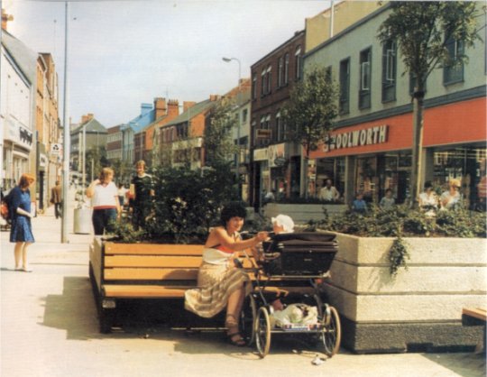
Modern Lisburn's centre suffers from some
unfortunate redevelopment. However, a scheme to pedestrianise Bow
Street, just embarked upon, should greatly improve the town's centre
and the through-pass road system is nearly complete. The town centre
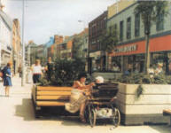
has an excellent range of shops and an open air market at Smithfield
Square draws great crowds every Tuesday morning.
Other amenities of Lisburn include the twenty-five
acre and well wooded Wallace Park which was given to the town by Sir
Richard Wallace. There is good fishing in nearby streams; the town
has a modern indoor swimming pool and facilities for many outdoor
and indoor sports and social activities.
 |
|
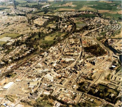
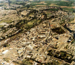
Aerial view of Lisburn |
Although man-made fibres have, to a great extent, usurped linen,
that textile is still processed in the town as are the newer nylon
and terylene products. Hilden has, indeed, been making linen thread,
twines and cordages continuously since Napoleonic times.
Long established though the linen industry is, the
oldest activity of all in the Lisburn area is agriculture and many
of today's industries are still based on the land. Close to the town
is one of the country's largest factories for making animal feeding
stuffs and there are also two farm by-products factories within the
Borough. Other factories pack and export eggs, manufacture jam, can
all kinds of fruits and vegetables, process poultry and deal with
other types of farm produce.
Prominent among more modern industries are cabinet
making, ball-bearing manufacture and motor car production. Modern
furniture is made for home and overseas markets with several of the
new plants working almost wholly on export orders. Ball-bearings are
made almost entirely for export by a world famous firm. Other new
industries include the manufacture of tyre valves (by a large
American-owned business); wire rope; clothing; pressure lamps and
cookers; and life saving equipment. Development continues and other
new industries are moving into the industrial estates on the town's
perimeter.
The commercial aspect of Lisburn, too, is fast
developing. Many multiple stores are found in the town but a
significant feature of the commercial scene is the large family-run
business concerns that carry on long traditions of service.
Industrial development needs technical skills and
technical education has progressed alongside industry. Excellent
training and educational facilities are given in the textile,
engineering, furniture and building industries. The business life of
the town is also helped greatly through the services of an active
and progressive Chamber of Commerce.
Lisburn Economic Development Organisation
The Lisburn Borough Council has sponsored the
establishment of an organisation in order to promote industrial
development in its area.
The object of the organisation is to:
1. Encourage new firms to start in business. 2. To help existing
firms to survive and grow. 3. To promote closer co-operation of
development plans and industrial promotion programmes.
4. To attract new firms from elsewhere.
3. Aerial View of Lisburn.
Other Borough Towns and Villages
Aghalee
An attractive village in the centre of the
agricultural country bordering Lough Neagh, Aghalee stands on the
Lurgan to Crumlin road and has in recent years grown as a
'dormitory' village for both Lurgan and Lisburn. The village was the
birthplace of the famous portrait painter, Sir John Lavery. Close to
it runs the line of the old Lagan Navigation Canal.
Although it retains its agricultural links, Aghalee is a growing
village and both public and private houses are being built.
Ballinderry and Lough Neagh
Ballinderry, which has been called Ulster's 'Garden of Eden', stands
in the rich dairy farming area on the eastern side of Lough Neagh.
This was once a land covered with oak forests from whose trees the
timber for many naval ships was provided; the name 'Ballinderry'
(Townland of the Oaks) is a direct reference to this fact. With its
oak and apple trees this is still a very wooded part of Ulster and
is famous, too, for its onions - the expression 'as strong as a
Ballinderry onion' is well known throughout the area.
The area is rich in old buildings particularly in
the villages of Upper and Lower Ballinderry although at the latter
new houses and a school have been completed. At Portmore is the ruin
of the original church of St. Loo where Jeremy Taylor preached those
gentle exhortations which are immortalised in his books' Holy Living'
and 'Holy Dying'. Jeremy Taylor planned the Middle Church (although
he died before it was completed) which has an exquisite interior
that is the very essence of the 17th century. The high backed pews
and the three decker pulpit are very fine. Also of merit is the
Moravian Church which was founded in 1750 by John Cennick, a great
English preacher who was of Bohemian descent.
Between Ballinderry and Lough Neagh is Portmore
Lough (otherwise known as Lough Beg) and here, as well as Jeremy
Taylor's church, was the great castle built in 1664 by Lord Conway.
The castle had massive stables, 140 feet long, 35 feet wide and 40
feet high capable of stabling two troops of horses. After Conway's
death, castle and stables fell into neglect and were finally removed
in 1761. The deer park, once stocked with deer and wildlife of all
kinds, was then given over to farming.
Lough Neagh, one of the most attractive features of
this part of Ulster, is the largest fresh water lake in the British
Isles. Its waters are said to have the power of petrifying wood;
more important, however, is its fishing for here the pollan - or
fresh-water herring - is found in large numbers. Eels too, are
plentiful as are such coarse fish as pike, roach and perch.
Along the shores of the Lough are numerous picnic
spots and bathing areas - Sandy Bay, for example, is a delightful
corner. Regarded as an expansion of the Bann Valley, the Lough has
several legends to explain its existence. Most popular and colourful
-is that Finn McCool, the giant of the Giant's Causeway, formed the
Lough by simply grabbing up a lump of Irish soil and hurling it into
the Irish Sea. The space left behind formed Lough Neagh whilst the
lump of soil formed the Isle of Man. The two features are, in fact,
more or less the same size.
The Lough has always attracted tourists and has
often been written about. Many years ago the Rev. George Hill wrote
these lines, with the thought in his mind of the many immigrants
forced to leave this area:
Lough Neagh they used at close of day
Along thy silent strand,
To watch the sun set far away,
O'er old Tir-Eoghan's land,'
The fading light how like the flight
Of hope from Inisfail
From holy hill so green and bright
From haunted wood and vale.
And often were their children told
Of Lough Neagh's silent strand,
And of the sunset, spread like gold
On old Tir-Eoghan's land.
Lough Neagh's one island is Ram's Island, less than
a mile long, heavily wooded and with a ruined round tower upon it.
Roughly equidistant from Ballinderry and Glenavy, the island is
celebrated in this verse:
'Tis pretty to be in Ballinderry,
'Tis pretty to be in Aghalee;
But prettier far on Little Ram's Island
Trysting under the ivy tree.
Culcavy
One mile to the west of Hillsborough, Culcavy was first developed as
a distilling centre close to the Lagan Navigation Canal and that
waterway provided its raw materials. During the 19th century
distilling was replaced by the woollen industry which, in turn, was
superseded by the weaving of linen. The place is still a small
industrial settlement and plans are in hand to provide new
industries.
Dromara
A busy little town in the south of the Borough, Dromara nestles in
the hilly country which rises to the beautiful Dromara Mountains
whose highest peak is Slieve Croob (1502 feet). This was, at one
time, Magennis territory but it passed into the ownership of the
Downshire family who built a market house in the town. The River
Lagan rises on the northern side of Slieve Croob and runs swiftly
through the town.
Although Dromara now grows in favour as a centre
from which to explore this beautiful countryside, the place was for
long almost unknown - largely explained by the fact that Dromara was
by-passed by roads and railways serving the larger towns all around.
For those who know where to explore this area there is much to
enjoy. The beautiful countryside can be surveyed in panoramic
splendour from the Rib and Windy Gap roads which climb up over the
mountains towards Castlewellan and beyond. Local farms are small and
are often farmed by men who also work at other jobs - a reminder
that Dromara was once the centre for flax growing and of its
preparation for the linen mills. The ending of the linen industry
here meant that no longer was there an industry to employ large
numbers of people. Many people left the Dromara area but others
turned to a 'dual role' of farming allied to another occupation.
Dromara's houses huddle in their valley beside the
Lagan spanned by an old and rather beautifully weathered stone
bridge. Of great interest are two fine churches which are both of
architectural and historic merit. St. John's Church (Church of
Ireland), although ancient, was rebuilt in 1811 and again in 1894
when the transepts were added to make it cruciform in plan. Recent
restorations have greatly enhanced the beauty and comfort of the
church. The organ is of note, it was built in 1907 by Megahey of
Cork and was electrified and rebuilt fifty years later.
Of great beauty is the James Pollock Memorial Window
which was installed in 1974 in memory of that man's sixty years of
service as church organist.
The other church here is the First Dromara
Presbyterian Church. Built in 1826 it was a typical barn of a
building (known as the big meeting house) erected on Artana Hill
overlooking a wide countryside with views extending as far as Black
Mountain and Cave Hill. The church has been remodelled in recent
years and has modern pews. It has, like St. John's, a hall attached
to it - both are features of the last twenty years or so.
 |
 |
|
Bow street Lisburn |
The
busy village of Dunmurry on the road to Belfast |
Drumbo
A farming village amid the fields and winding lanes that lie between
the Lagan and the southern part of the Borough, Drumbo is known for
its ancient round tower, the only one left in Down. Indeed there
were formerly three such towers here but now only the stump of one
remains resembling a windmill tower. It stands behind the
Presbyterian church, a building that dates from 1882. There are
several large estates in the Drumbo area including those of
Belvedere and Trench House which lie quite close to the village. New
Housing Executive dwellings have been built recently in Drumbo.
Drumbeg
One of the parishes on the southern edge of Belfast, Drumbeg (whose
name means 'Little Edge') is basically a residential community and
one that has in many ways not changed a great deal since 1846 when
an entry in the Parliamentary Gazetteer said of it:
"It is rich in those features of landscape which
possess beauty without grandeur and picturesqueness without power.
Villas are so numerous, both within and immediately beyond the
limits, as almost to melt into one another, and form a pervading or
general feature of the charming scenery".
The tower of the parish church of St. Patrick dates
from 1 798 but the spire is later (1833) as is the rest of the
church which was rebuilt in 1870. The bells, however, like the tower
date from the preceding building on the site and were cast in 1685.
The church's lych-gate is a very handsome one.
The village stands next to the Lagan and at Drum
Bridge the Council maintains a car park which has direct access to
the river's tow path.
Dundrod
On the road from Lisburn to Antrim and Belfast Airport, Dundrod is a
small village in the rather level country between Lough Neagh and
the Belfast Hills. Some residential development has taken place but
basically Dundrod consists of its original centre grouped around the
church, church hall, school and post office. The Borough Council,
however, owns the pits area at the Ulster Grand Prix circuit and it
is expected that improvements will be made over the next few years.
This racecourse is one of the most famous in the world. The major
race, the Ulster Grand Prix, draws crowds of spectators from many
countries.
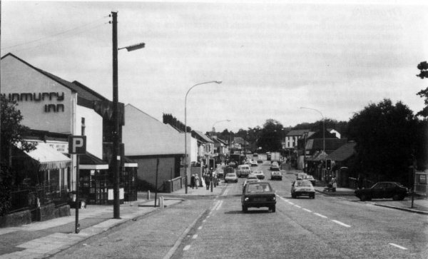
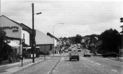
Dunmurry
Another of Belfast's southern outposts, Dunmurry, is situated along
the Belfast to Lisburn road and has in recent years grown enormously
as private and public housing estates have been built. The
population is now equal to that of a town and Dunmurry has its own
shops, schools, churches and other modern amenities.
Backed by the lovely Collin Mountain, with its
famous Collin Glen, Dunmurry is flanked by the River Lagan which,
although canalised, still retains the atmosphere of a quiet rural
waterway. All around Dunmurry's housing estates are the pleasant
open landscapes which include the golf course, the Antrim Hills,
Moss Side and the Lagan Valley. There are also extensive playing
fields in and around Dunmurry.
Close to Dunmurry is the smaller village of
Derriaghy, an attractive place, whose parish church is of interest.
The church registers here date from 1696, unusually old for Ulster.
 |
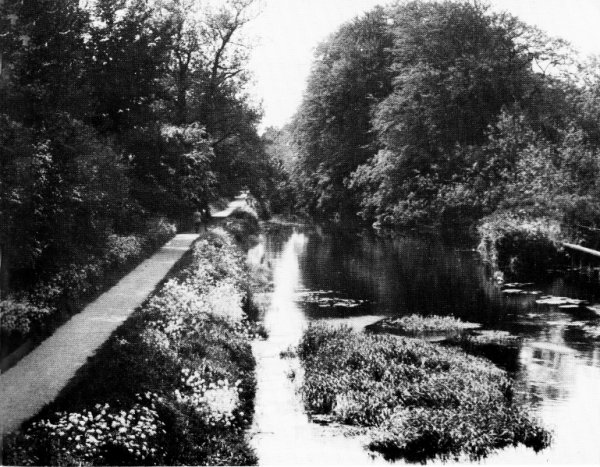
|
On the Lagan Towpath - now part of the Ulster Way. |
Edenderry
Also close to the southern border of Belfast is Edenderry, a village
beside the Lagan Canal which cuts a straight path across the
countryside past the estate of Edenderry House. Here is Shaw's
Bridge, well known to artists and photographers for this is one of
the more beautiful stretches of the canal, a waterway that was built
between 1754 and 1764 from funds gathered by a local tax on ale and
whiskey sales. Although a pint of porter then sold for only two
pence a total of �70,000 was amassed for the Lagan Canal scheme.
Beside the canal is the famous linen mill around
which, in the 19th century, the village grew up. The mill itself was
built on the site of an older linen bleachgreen. The rows of
red-brick terraced houses for the mill workers overlook the mill and
the Lagan.
Just outside Edenderry is the Giant's Ring, a most
important pre-historic relic that was probably constructed about
four thousand years ago. Its 15 foot high ramparts form a regular
circle 250 yards in diameter and there are superb views across the
Lagan valley. The circumference is composed of seven sections and at
the centre stands a dolmen of seven great stones supporting one more
in table form, all of basalt.
Glenavy
On the eastern side of Lough Neagh, Glenavy stands at the junction
of roads to Belfast, Lisburn, Antrim and Moira, and is on the
Glenavy river which enters the Lough opposite Ram's Island and close
to Sandy Bay.
Glenavy has had a long history and until the 17th
century was called 'Lanaway 'from' Lann-Allaich' (the church of the
dwarf), the dwarf in question being a priest who was installed by
St. Patrick to look after the parish. Also of historic note is Crewe
Hill, (629 feet) where the ancient kings of Ulidia (Eastern Ulster)
were crowned. Brian Boru and his Munstermen used to visit this site
to exchange gifts with their Ulster counterparts.
Hillhall
This is a small and scattered village whose houses, church, school
and two factories are spread out along part of the former Belfast to
Lisburn turnpike road not far distant from Drumbo.
 |
 |
|
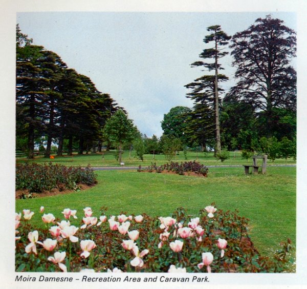
Moira Demesne -Recreation Area and
caravan Park |
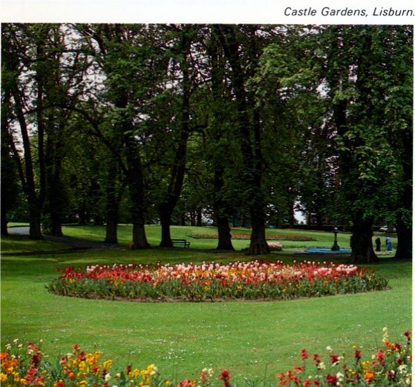
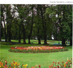
Castle Gardens, Lisburn |
Hillsborough
A small and delightful town, Hillsborough stands south of Lisburn on
the main Belfast to Dublin road and is an almost entirely unspoilt
18th-19th century town, a visual joy to the lover of good
architecture. The town, in fact, received its charter of
incorporation in 1661 but was laid out in the first half of the 18th
century and Hillsborough has a rare wealth of Georgian buildings.
The town takes its name from Sir Arthur Hill who, in
about 1650, built Hillsborough Fort which, with its eight foot high
earth ramparts and stone revetments looks proudly out over the town.
King Charles the Second made this a royal fortress and Sir Arthur
was constable with twenty warders. The fort commanded the strategic
pass of Kilwarlin and was used in 1690 by William the Third on his
way to the Battle of the Boyne. The room in which he slept remains
today. The gatehouse is an impressive rectangular two-storey
structure of rubble masonry with brick dressings and battlements and
tall square corner towers. The Fort was given to the State by the
Downshire family (the Hill family later became the Downshires) in
1959 but it is not open to view.
In the town centre is the Market house, a charming
building of three blocks pyramidally arranged. The ground floor, on
a granite plinth, has a nine bay frontage with round open arches in
the central block and round-headed windows in the pyramidal roofed
blocks; the central square block of three bays rises another storey.
Above rises a square clock tower with ornamental urns, cupola and
banner weathervane.
 |
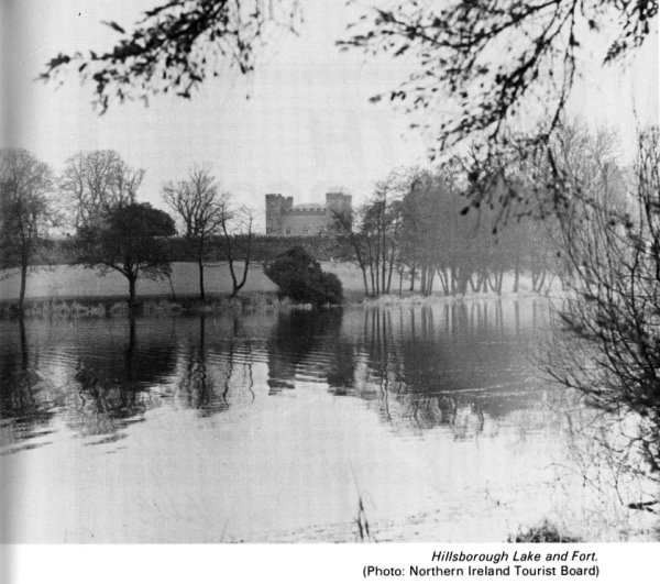
| Hillsborough Lake and Fort. (Photo: Northern Ireland Tourist Board) |
Extremely fine is the parish church of St. Malachy,
built in 1636 and restored in the 18th century by Wills Hill (later
the First Marquis of Downshire). Wills Hill had hoped his church
would be afforded cathedral rank but here he was disappointed.
Superbly sited on a hillside off the main street and near
Hillsborough Fort, the church is approached along an avenue of lime
trees interspersed with rhododendrons. Close to the church, and now
leading to the churchyard is a rather curious pinnacled gateway that
maybe a surviving fragment of the earlier church of 1636. Also close
to the church is a memorial, carved by Rosamund Praeger, to the
Composer Hamilton Harty. Externally the notable feature of the
church is its three-storey tower capped by pinnacles set at the
corners with, from the centre a soaring needle of a spire.
Internally the church is largely unspoiled (although altered in 1898
by Sir Thomas Drew) and is notable for the quality of its woodwork,
which include the high oak pews, the tall octagonal pulpit with
sounding board, the bishop's throne and the two organs - a small
instrument of 1795 by George Pike England and a more massive John
Snetzler organ of 1773.
Also of rare interest is the Sexton's House and
Parish Room with, at each end, a low pavilion capped by Gothic
spirelets. Both were originally school houses - for boys and girls
respectively.
Yet another of Hillsborough's notable buildings is
the Castle, standing in a large and beautiful park, and formerly
Government House. This is a pleasing though not over-impressive two
storey house that was completed in 1797 to the designs of R.F.
Brettingham. It incorporates a few fragments of a far smaller house
that was built in 1760. In the 1830's and 1840's the house was much
enlarged and extensively remodelled.
Much of the credit for Hillsborough's layout and
design must go to Wills Hill, the first Marquis of Downshire. He was
a quite remarkable man and greatly appreciative of the Georgian
style of architecture. Previously the surrounding area had been
controlled by the Maginesses for centuries. The village was then
called Cromlyn and to it as English 'Planters' came the Hill family.
The first to arrive was Moyses Hill who came with the army of
Elizabeth the First. He married the sister of Sorley Boy MacDonell
and settled in the village. His son, Peter, strengthened the old
castle and then, after ousting the Maginess family, built the fort.
The Hill family fortunes grew and by the end of the 17thcentury (by
which time they had called the place after themselves) were among
the richest families in the British Isles.
The town today has a quality unique in Ulster and
the re-routeing of the main Belfast to Dublin road around
Hillsborough should help further to preserve its character and
qualities. One modern building of note is the Lisburn Borough
Council's main administrative block which, in Georgian style, was
built on the site of the 18th century Downshire Hotel which was
burnt down in 1943. There are extensive public and private housing
estates near Hillsborough and it is planned to build more houses and
light industrial premises.
Lambeg
On the eastern side of Lisburn, Lambeg stands on the road and rail
routes to Belfast and on the River Lagan which here, with its
pleasantly wooded banks, is in one of its most attractive reaches.
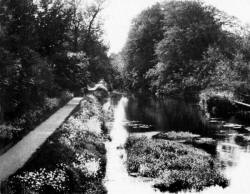
Here, too, is the line of Lagan Navigation Canal although it is now
out of use and its locks are neglected and overgrown. Overlooking
the village is the 620 foot height of White Mountain, a noted local
landmark and a southern outpost of the Belfast Hills. From its
summit fine views can be had to the Mourne Mountains.
Lambeg grew up around the local linen industry and
it has developed industrially and residentially in recent years. The
Lambeg Industrial Research Association has its headquarters and
laboratories here and these have been in the forefront of all new
textile developments and processes in Ulster. Lambeg was also once
famous for its drums and for the rallies of Orangemen and their
characteristic drumming parties. The largest drum was referred to as
a Lambeg Drum and to beat a tattoo on it was to "beat a Lambeg".
This Lambeg Drum can still be seen in Orange Order processions.
Maghaberry
This village stands between Lisburn and Moira just north of the
Belfast railway. Anew prison is at present under construction close
to Maghaberry and this is expected to lead to further developments
in the village during the next five years. At nearby Magheragall is
a handsome Presbyterian church and an older parish church whose
chancel contains several features of interest.
 |
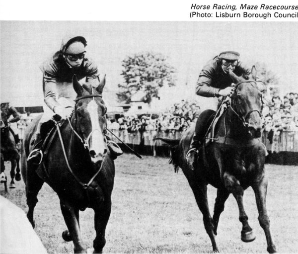
| Horse Racing, Maze Racecourse. (Photo: Lisburn
Borough Council) |
Maze
Also situated between Lisburn and Moira, the village of Maze stands
on the Lagan"s southern bank. The village is noted for the Down
Royal Racecourse, the oldest in Ireland and the venue, each July,
for the Ulster Harp Derby. Other important races take place
throughout the year. The racecourse belongs to a very old
established association, "The Down Royal Corporation of
Horsebreeders" who were founded in 1685 by a Royal Charter that was
granted by James the Second for the "improvement of horse breeding
in the County of Down".
The Maze racecourse draws crowds from Belfast at
race times and the village becomes very busy. The racecourse is on
the south side of the village centre; to the north of it is Lissue,
a small hamlet with the Lissue Hospital as the principal building.
Moira
West of Lisburn and at the western extremity oft he Borough, the
small town of Moira stands on the main road and rail routes from
Belfast and Lisburn to Portadown.
Once known as Magh Rath (the plain of the fort),
Moira has long been a place of importance and a fierce battle took
place here between the native people and Danish marauders who
ravaged the countryside during their incursions from Lough Neagh to
which they had gained access by way of the River Bann from
Coleraine. Until the 17th century the land in this area belonged to
the O'Lavreys but it passed, in that century, to George Rawdon from
Yorkshire and to him and his family is owed the credit for the
planning and building of Moira. The Rawdon family were, in fact,
land agents to the Second Viscount Conway and Killultagh who came
also from Yorkshire - from Otley in the West Riding.
The family built a huge mansion in a beautiful
demesne on the edge of Moira and the extensive gardens were
beautified by Sir Arthur Rawdon with rare plants and trees brought
from the West Indies. In 1761 Sir John Rawdon became the Earl of
Moira but later all his property passed to the Batesons, a family
that afterwards became Lords of Deramore. The house has long since
gone but the Moira demesne, after years of use as pasture land, is
now a public park.
Before 1722 Moira was in the parish of Magheralin
but in that year it was made a parish in its own right and shortly
afterwards a monthly market was started, to promote the linen trade
and to sell general produce. Although this market is no longer held,
Moira keeps its importance as a commercial centre. The town has
expanded, too, as a residential area with extensive estates of both
public and private houses.
Moira's broad main street was laid out on the slope
of a hill in the 18th century and it has, with adjacent
thoroughfares, a close knit character of distinction. A notable
building is the Town Hall which, although no longer serving civic
needs, still retains its air of solidarity and dignity. A wall of
the former Moira Castle and the remains of ornamental ponds nearby,
is all that survives of the former magnificence of the Rawdons. The
house was pulled down in 1870 but the 40 acres demesne, as
previously mentioned has been developed as a public park. A transit
caravan and camping park is but one of its new amenities.
The First Presbyterian Church was built in 1860 but
much older is St. John's Parish Church which was started in 1722 and
whose architectural lines blend with the 18th century houses of
Moira from which it stands apart. The Georgian elegance of the
church is enhanced by the tall copper-clad spire. Of interest within
is the ancient reredos with the creed inscribed thereon in gold
letters whilst the communion rails are said to have come from the
demolished castle.
Moira also has numerous other 18th century buildings
of interest including one opposite the Market House that dates from
1735. The Chantry School, used for services before the church was
built, is even older and, on the edge of the town is Berwick Hall, a
typical two-storey thatched Yeoman 'Planters' house of about 1700.
Many other 18th century houses were built for letting and can be
distinguished by their arched carriage recesses.
Moira has several industries including a poultry
processing plant which provides substantial employment and on the
outskirts of the town is a lime works.
Not far distant is Soldierstown, a village close to
Broad Water, the header reservoir for the Lagan Navigation Canal.
The canal's engineer, Richard Owen, is buried in the nearby Church
of Ireland graveyard.
Plantation
Close to the Lisburn motorway interchange, the village of Plantation
originally consisted of a cluster of workers' houses alongside the
bleachworks and warehouse that were set up in the 18th century by
John Barbour who introduced thread making to this area. Of the
original settlement which, by its name, presumably dated from the
days of the Planters, little or nothing now survives.
Ravarnet
North east of Hillsborough is Ravarnet, a small residential
community that developed in the 19th century alongside its weaving,
corn and flax mills. Unfortunately, much of the weaving mill site is
now derelict although the actual building is used for the storage,
baling and distribution of waste paper.
Stonyford
At the centre of several by-roads, Stonyford stands south of Dundrod
in the level country between the Belfast Hills on the one hand and
Lough Neagh on the other. This is a natural collecting area for
water and the large reservoir here is popular with anglers. The
village itself is small and pleasantly rural and there are no plans
for immediate development in the area.
Local government reorganisation in 1973 brought fundamental changes
and one of the most important of these was the new role that was
given to local authorities in relation to the provision of
recreation facilities. Lisburn Borough Council is thus charged with
a responsibility to provide adequate facilities for recreational,
social, physical and cultural activities in the Borough and to
provide tourist amenities, entertainments and other activities.
Parks and Sports Facilities
The Borough Council provides parks and sports facilities in Lisburn,
Dunmurry, Moira and Hillsborough.
At LISBURN, the Recreation Centre at Warren Park
includes parkland, outdoor facilities and changing rooms. These
outdoor facilities include children's play areas; a pitch and putt
course; putting green; three football pitches; a rugby pitch; two
hard porous pitches (one with floodlights); a running track; a
bowling green and tennis courts - all served with adequate car
parking. There are plans, too, to build an indoor recreation centre
on the same site, a building that will provide facilities for many
sports as well as for community and arts activities.
In the centre of the town at Market Place, is the
indoor swimming pool which is one of the busiest in Northern
Ireland. It is close to bus and rail stations, has its own car park
and caters for galas and other events as well as for general
swimming. Details from the manager - Tel: Lisburn 2306.
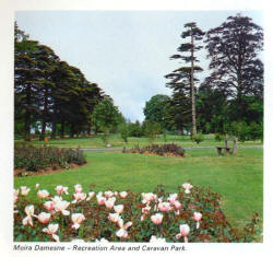
Just outside MOIRA are the 44 acres of Moira Demesne
which have been developed and provide picnic areas, children's play
areas, a transit caravan and camping site and, of course, car
parking.
Duncan's Park and the land around it has been
developed for recreation purposes with paths through the woodlands
and with a children's play area. Here, too, a car park is provided.
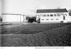 |
| Glenmore Activity Centre with squash courts. |
At GLENMORE, HILDEN a site alongside the River Lagan
has been developed from former industrial premises. This centre
includes a large hall, committee rooms, coffee bar, changing rooms,
a children's play area, two football pitches and two squash courts.
Community Activity Centres have been built at
TWINBROOK, KNOCKMORE and SEYMOUR HILL and these centres will provide
opportunities for sport, social and cultural activities.
A wide range of sports clubs is found in the Borough
and an important role is played by the LISBURN SPORTS ADVISORY
COUNCIL. It was active in the former Borough and then in 1975 it
adopted a new constitution which ensures that it provides a service
to the enlarged Borough of today. It advises the Borough Council on
the collective opinions of local sports interests on such matters as
the improvement of existing sports facilities and the provision of
new ones. It encourages participation in sports and physical
recreation and makes sure that the public is aware of the sports
opportunities in the area. Full details of the Council and its work
can be obtained from the Honorary Secretary at the Borough Offices,
The Square, Hillsborough (Tel: 682477).
A Directory of Sport is issued by the Council and it
gives details of clubs with the following sports:
Aero-model flying; angling; archery; Association
football; athletics; badminton; basketball; billiards; bowling
(outdoors and indoors); boxing; camogie; canoeing; clay pigeon
shooting; cricket; cycling; darts; gaelic football; golf; hockey;
hurling; karate; keep-fit; lifesaving; motorsport; netball;
orienteering; pigeon racing; riding and showjumping; rugby football;
snooker; squash; sub-aqua; swimming; tennis; table tennis; taekwondo;
water skiing.
As well as these sports there are TWO PRIVATE GOLF
CLUBS in the Borough. These are the Dunmurry Golf Club with an 18
hole parkland course at Upper Dunmurry Lane, Dunmurry and the
Lisburn Golf Club with an 18 hole parkland course at Hillsborough
Road. A public nine hole course is under construction at Aberdelghy
near Lisburn.
 |
 |
|
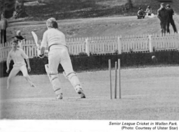
Senior League Cricket in Wallace Park. (Photo:
Courtesy of Ulster Star) |
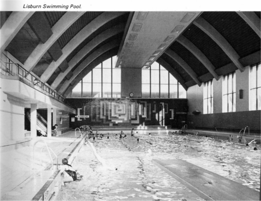
Lisburn Swimming Pool. |
Close to the village of Maze is the DOWN ROYAL
RACECOURSE, the oldest in Ireland and the venue, every July, for the
Ulster Harp Derby.
Part of the Dundrod motor-cycle circuit is within
the Borough.
The Arts
Co-operating with the Arts Council of Northern Ireland, the Lisburn
Borough Council holds dramatic and orchestral concerts, art
exhibitions and other cultural events.
The Lisburn Arts Advisory Council was formed in 1975
to promote arts and cultural services working in conjunction with
both the Borough Council and the Arts Council of Northern Ireland.
Members are drawn from the Borough Council, local organisations and
the general public and cultural activities promoted include drama,
music, the visual arts and photography. Many events are presented
each year and the Council aims to widen its scope in the future.
Full details of the Council and its work can be obtained from the
Honorary Secretary at the Borough Offices, The Square, Hillsborough
(Tel: 682477
 |
 |
|
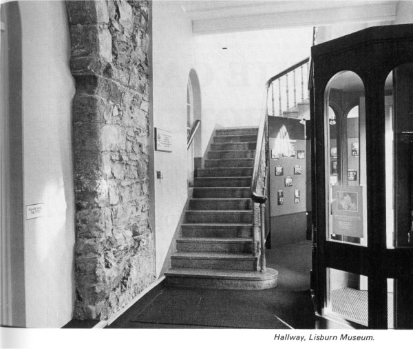
Hallway, Lisburn Museum. |
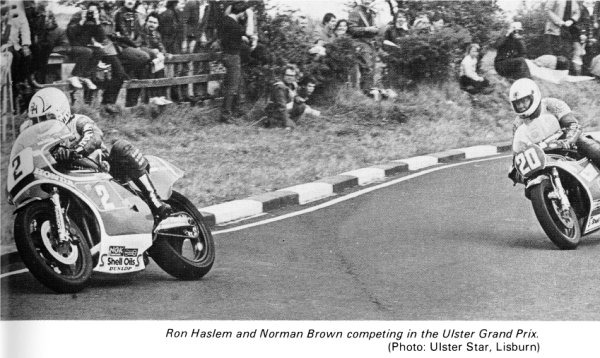
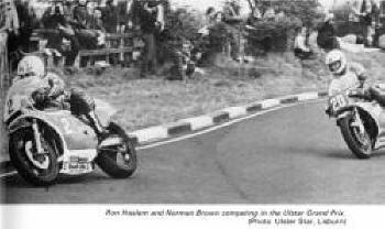
Ron Haslem and Norman Brown competing in the Ulster
Grand Prix. (Photo: Ulster Star, Lisburn) |
Lisburn Museum
Housed in the Assembly Rooms, Market Square, the recently opened
Lisburn Museum aims to collect, preserve, research and display
objects and information which relate to the area of Lisburn Borough.
Permanent displays will eventually include the Archaeology, Local
History and Natural History of this region. There is also an Art
Gallery which displays works by artists of some local connection,
topographical views and portraits of local worthies.
Tourism
The Borough's many tourist assets include its attractive villages;
historic buildings and monuments, beautiful scenery, excellent
hotels and country farm-houses. A major tourist attraction is Lough
Neagh whose 65 miles of shoreline is well wooded and has small
hidden harbours and sandy beaches. At Moira close to the Lough, is
the Borough Council's transit caravan and camping site.
Much of the Lagan Valley Regional Park lies within
the Borough and it has within its 4,140 acres, much to interest the
tourist. The Park extends from the first lock at Stranmillis as far
as the Union Locks at Sprucefield.
Tourist information - including a guide to the Lagan Valley, a
folder on Lough Neagh and details of Moira's camping and caravan
site and accommodation in the Borough can be obtained from the
Borough Offices, The Square, Hillsborough(Tel: 682477).
Community Activities
The Borough Council has two community centres in Lisburn. The West
Lisburn Community Centre is widely used for social and recreational
activities whilst the Bridge Community Centre at Railway Street was
acquired in 1979 and provides further much needed facilities.
The Council has also, since 1973, provided services
to local community associations in the form of grants to help with
running costs of community or resource centres or to help community
associations with their administrative expenses.
|